


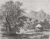


Hawaii, Samoa, Tonga and Tahiti are among the scattered island groups in these maps of Polynesia, which run from the late eighteenth century to the mid-twentieth. Regional atlas sheets reach as far as the Tuamotus and Gambier Islands, often setting Polynesia beside Melanesia and Micronesia, while Vandermaelen's adjoining sections focus on individual archipelagos. Admiralty charts and exploration maps follow passages and named island groups, political maps mark colonial possessions, and decorated atlas sheets include island views. The prints show Tahitian breadfruit, Moorea's mountain landscape and Samoan women.
EU orders up to €150 are sent VAT- and duty-paid — no additional taxes on arrival
Authenticity Guaranteed - We only sell original antique & vintage items
Can we help? Call us on +44-208-960-3476 • FAQs
All our products are exempt from US tariffs — no additional duties or taxes payable on arrival.


- Shop by Country
- Shop by Cartographer
- Shop Maps by Type
- Shop Prints by Subject