


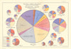


Maps turned social conditions into evidence—and evidence into reform. This collection brings together poverty, population and social-survey maps from the late nineteenth and early twentieth centuries. At its heart are Charles Booth’s colour-coded Maps Descriptive of London Poverty, which classified streets by income and social class; LSE’s Charles Booth’s London makes the maps and notebooks publicly accessible, and the archive is inscribed on UNESCO’s UK Memory of the World Register. Booth’s surveys sit beside the interwar New Survey of London Life and Labour and Seebohm Rowntree’s study of York. Joseph Rowntree and Arthur Sherwell’s temperance and prohibition maps chart licensed houses, saloons and alcohol laws. Related material includes W. T. Stead’s map of brothels and saloons in Chicago’s Levee district, Dublin Civic Survey maps of tenements, sanitation and population, William Booth’s Salvation Army allegory, Poor Law unions, workhouses, overcrowding, education and census maps: cartography used to investigate inequality and argue for change.
EU orders up to €150 are sent VAT- and duty-paid — no additional taxes on arrival
Authenticity Guaranteed - We only sell original antique & vintage items
Can we help? Call us on +44-208-960-3476 • FAQs
All our products are exempt from US tariffs — no additional duties or taxes payable on arrival.


- Shop by Country
- Shop by Cartographer
- Shop Maps by Type
- Shop Prints by Subject