


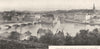


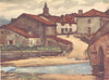


Béarn and the French Basque Country lie behind these maps of Pyrénées-Atlantiques, many of them drawn when the department was still called Basses-Pyrénées. Janssonius maps Béarn as an old province, coastal charts examine Bayonne, the Adour estuary and Biarritz, and inland plans cover Pau and the mountain approaches. Wine maps locate Jurançon and its neighbours, and military maps follow the battle of Orthez. The prints show the château at Pau, the promenades of Biarritz, festivities at Bayonne and Basque villages, and views and excursion maps follow the Pyrenean valleys across the department's borders, in material from the seventeenth to the mid-twentieth century.
EU orders up to €150 are sent VAT- and duty-paid — no additional taxes on arrival
Authenticity Guaranteed - We only sell original antique & vintage items
Can we help? Call us on +44-208-960-3476 • FAQs
All our products are exempt from US tariffs — no additional duties or taxes payable on arrival.


- Shop by Country
- Shop by Cartographer
- Shop Maps by Type
- Shop Prints by Subject