






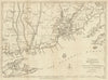



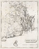




Streets, wards and the names of individual landowners fill these maps of Rhode Island, which chart a small state at an unusually local scale. Daniel Glover Beers's nineteenth-century maps cover Providence, Newport and Warwick as well as smaller villages and townships, with folding sheets and paired village maps extending across the state. Earlier regional maps set it beside Connecticut and Long Island Sound, and coastal charts follow Narragansett Bay, Block Island and neighbouring New England waters. The prints show its places and coast, in material from the eighteenth to the twentieth century.
EU orders up to €150 are sent VAT- and duty-paid — no additional taxes on arrival
Authenticity Guaranteed - We only sell original antique & vintage items
Can we help? Call us on +44-208-960-3476 • FAQs
All our products are exempt from US tariffs — no additional duties or taxes payable on arrival.


- Shop by Country
- Shop by Cartographer
- Shop Maps by Type
- Shop Prints by Subject