


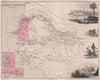


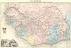


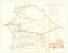






The slave-trading island of Gorée, Fort Saint-Louis and the growing city of Dakar run through these maps of Senegal, dating from 1683 to 1973. Early eighteenth-century charts by Jacques-Nicolas Bellin and Jean-François de La Harpe show the river estuary, Fort Saint-Louis, Rufisque and Gorée, a major Atlantic slave-trade post under French control from 1677. Nineteenth-century maps for the Society for the Diffusion of Useful Knowledge trace journeys across Senegambia towards the Niger basin, while Victor Levasseur and Thomas Bradford map French West Africa. Twentieth-century plans show Dakar, Saint-Louis and the Cap-Vert peninsula expanding, and prints depict natural history and coastal landscapes.
EU orders up to €150 are sent VAT- and duty-paid — no additional taxes on arrival
Authenticity Guaranteed - We only sell original antique & vintage items
Can we help? Call us on +44-208-960-3476 • FAQs
All our products are exempt from US tariffs — no additional duties or taxes payable on arrival.


- Shop by Country
- Shop by Cartographer
- Shop Maps by Type
- Shop Prints by Subject