


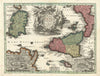


Mount Etna, the harbours of Palermo and Syracuse and a history running from the Sicels to Operation Husky make these maps and prints of Sicily an absorbing subject. The largest island in the Mediterranean, lying beyond the Strait of Messina, it passed from Greek and Carthaginian conflict and Roman rule to Vandals, Ostrogoths, Byzantines, Normans and Aragonese kings, then to the Kingdom of the Two Sicilies and Garibaldi's invasion of 1860. The maps show its regional divisions, harbour plans, maritime charts and the surrounding islands, while the prints depict its cities, volcanic landscape and varied coastline.
EU orders up to €150 are sent VAT- and duty-paid — no additional taxes on arrival
Authenticity Guaranteed - We only sell original antique & vintage items
Can we help? Call us on +44-208-960-3476 • FAQs
All our products are exempt from US tariffs — no additional duties or taxes payable on arrival.


- Shop by Country
- Shop by Cartographer
- Shop Maps by Type
- Shop Prints by Subject