


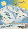


The modern ski trail map emerged as winter sport expanded from touring into an organised resort experience. Early examples relied on conventional topography, route diagrams and pictorial views, but increasingly had to make a complex mountain legible: lifts, pistes, villages, gradients and connections seen at once. Otto Martin Müller’s maps of Swiss resorts, published in 1949, mark a transitional stage, combining cartographic clarity with an inviting, illustrated sense of place. The decisive figure was Austrian panoramist Heinrich C. Berann. From the 1930s onwards, Berann developed the oblique bird’s-eye landscape into a persuasive form, later producing maps for European and American ski areas. His manipulated viewpoints clarified terrain that no single natural perspective could reveal, while painted snow, light and atmosphere transformed practical guides into works of art. Later artists, notably Pierre Novat and James Niehues, extended this visual language, creating the familiar modern piste map: informative, imaginative and immediately recognisable.
EU orders up to €150 are sent VAT- and duty-paid — no additional taxes on arrival
Authenticity Guaranteed - We only sell original antique & vintage items
Can we help? Call us on +44-208-960-3476 • FAQs
All our products are exempt from US tariffs — no additional duties or taxes payable on arrival.


- Shop by Country
- Shop by Cartographer
- Shop Maps by Type
- Shop Prints by Subject