


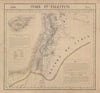

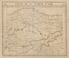


Damascus, Aleppo and the ruins of Palmyra lead these maps and prints of Syria, which run from 1572 to 1965. Surveys cover Hama, Homs, Latakia, Margat and Mount Hermon, while regional maps set the country beside Lebanon, Palestine, Jordan, Iraq and Cyprus, with geological charts of Anatolia and maps of lighthouses. First World War maps follow the Hejaz Railway, the Arab Revolt and actions at Kiswe, Kaukab, Haritan and Deraa, down to the armistice boundaries. City plans show central Damascus and Palmyra, and the prints depict the St Paul tower, the arches of a classical sun temple, the Salahieh hill and seventeenth-century Syrian women's costume.
EU orders up to €150 are sent VAT- and duty-paid — no additional taxes on arrival
Authenticity Guaranteed - We only sell original antique & vintage items
Can we help? Call us on +44-208-960-3476 • FAQs
All our products are exempt from US tariffs — no additional duties or taxes payable on arrival.


- Shop by Country
- Shop by Cartographer
- Shop Maps by Type
- Shop Prints by Subject