


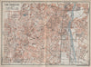


Yosemite and Yellowstone share the pages with big-city streets in maps from The United States with excursions to Mexico, Cuba, Porto Rico, and Alaska, Baedeker's fourth edition of 1909. Route maps and town plans cover New York, Boston, Chicago and the western cities, along with the university towns of Cambridge and New Haven, and building plans guide visitors around the Capitol and the Metropolitan Museum of Art. Excursion maps reach the White Mountains as well as the national parks, Gettysburg adds a battlefield, and coastal sheets link Alaska with British Columbia and the Pacific approaches, while Mexico and the Caribbean carry the guide beyond the mainland.
EU orders up to €150 are sent VAT- and duty-paid — no additional taxes on arrival
Authenticity Guaranteed - We only sell original antique & vintage items
Can we help? Call us on +44-208-960-3476 • FAQs
All our products are exempt from US tariffs — no additional duties or taxes payable on arrival.


- Shop by Country
- Shop by Cartographer
- Shop Maps by Type
- Shop Prints by Subject