


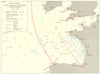

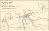


The pursuit of the Bismarck, the Battle of the River Plate and the D-Day landings appear in these maps from The War at Sea 1939-1945, Captain S. W. Roskill's official naval history, published by Her Majesty's Stationery Office in London between 1954 and 1961. They are drawn from Volume 3, The Offensive Part I. Charts show Atlantic convoy routes, U-boat operating areas and anti-submarine commands, and tactical plans cover the battles of Savo Island and the Coral Sea. Mediterranean maps follow Operation Torch at Algiers, the invasion of Sicily, the Anzio landings and Operation Dragoon in southern France, while others show the Arctic convoys to Murmansk, the defences of Scapa Flow and the Operation Neptune sectors on the Normandy coast.
EU orders up to €150 are sent VAT- and duty-paid — no additional taxes on arrival
Authenticity Guaranteed - We only sell original antique & vintage items
Can we help? Call us on +44-208-960-3476 • FAQs
All our products are exempt from US tariffs — no additional duties or taxes payable on arrival.


- Shop by Country
- Shop by Cartographer
- Shop Maps by Type
- Shop Prints by Subject