


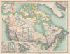


The waterfront, King Street and Yonge Street, Union Station and the parliament buildings at Queen's Park recur in these prints of Toronto, which follow the Ontario city as it grew. Colleges, hospitals and churches rise beside the commercial centre, royal visits, civic ceremonies and the aftermath of the Rossin House fire add events, and views from the island show the approach from the lake, while street corners bring the city down to individual buildings and traffic. The maps include town plans by Baedeker, Cram and other publishers and insets on maps of Ontario and the Great Lakes, with railways, steamship routes and regional sheets linking the city to Niagara, Ottawa and the province.
EU orders up to €150 are sent VAT- and duty-paid — no additional taxes on arrival
Authenticity Guaranteed - We only sell original antique & vintage items
Can we help? Call us on +44-208-960-3476 • FAQs
All our products are exempt from US tariffs — no additional duties or taxes payable on arrival.


- Shop by Country
- Shop by Cartographer
- Shop Maps by Type
- Shop Prints by Subject