
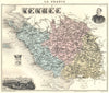


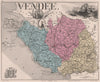


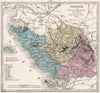










Atlantic islands, seaside harbours and the battlefields of the Revolutionary wars all find a place in the maps of the Vendée. They range from Hondius's older map of Poitou to nineteenth-century departmental sheets by Levasseur and Perrot, coastal surveys around Noirmoutier, the Île d'Yeu and the approaches to the Charente islands, and military maps reaching towards Nantes and Savenay during the uprising. The prints show La Roche-sur-Yon, sometimes under its earlier political names, Fontenay-le-Comte, Luçon, the ruins of Tiffauges and the harbour and beach at Les Sables-d'Olonne, along with regional costume and the Vendéen griffon. Offshore charts and maps of a round-the-world yacht race complete the maritime strand.
EU orders up to €150 are sent VAT- and duty-paid — no additional taxes on arrival
Authenticity Guaranteed - We only sell original antique & vintage items
Can we help? Call us on +44-208-960-3476 • FAQs
All our products are exempt from US tariffs — no additional duties or taxes payable on arrival.


- Shop by Country
- Shop by Cartographer
- Shop Maps by Type
- Shop Prints by Subject