


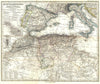

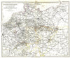


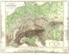


The detailed Gotha atlas maps here, crowded with place names, carry the name of Justus Perthes, which stands for a publishing house as much as for its founder. Johann Georg Justus Perthes (1749–1816) established the firm in 1785, but these sheets date from the 1860s and 1870s, when the business carried on under his name. Stieler's Handatlas is central, with mapping of Germany, France, Switzerland, the Mediterranean and North Africa that pays close attention to regional divisions and frontier districts. Some sheets carry German or Swedish naming, a sign of how widely Gotha cartography circulated.
EU orders up to €150 are sent VAT- and duty-paid — no additional taxes on arrival
Authenticity Guaranteed - We only sell original antique & vintage items
Can we help? Call us on +44-208-960-3476 • FAQs
All our products are exempt from US tariffs — no additional duties or taxes payable on arrival.


- Shop by Country
- Shop by Cartographer
- Shop Maps by Type
- Shop Prints by Subject