
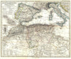

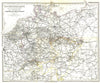


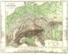


Dense, carefully lettered regional maps are the hallmark of the Stieler handatlas, published by Justus Perthes in Gotha, and the sheets here come from the atlas of 1879. They range across Europe, the Mediterranean and parts of North America, with especially close treatment of Prussia, the Rhine districts and the neighbouring Netherlands, Belgium, France and Switzerland. A railway sheet makes the transport network a subject in its own right, and maps of New England and the north-eastern United States take the atlas beyond Europe. It bore the name of Adolf Stieler, though later editions were the continuing work of the Perthes cartographic establishment.
EU orders up to €150 are sent VAT- and duty-paid — no additional taxes on arrival
Authenticity Guaranteed - We only sell original antique & vintage items
Can we help? Call us on +44-208-960-3476 • FAQs
All our products are exempt from US tariffs — no additional duties or taxes payable on arrival.


- Shop by Country
- Shop by Cartographer
- Shop Maps by Type
- Shop Prints by Subject