


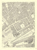


John Rocque’s survey of 1746 lays out Georgian London street by street, and these sheets reproduce it in the facsimile issued by Harry Margary and Phillimore in 1971. Detailed sections cover Westminster, the City, Shoreditch and Southwark and reach the developing edges around Mayfair and Rotherhithe, showing streets, buildings, gardens and open ground together, so the dense urban blocks stand out against the emptier margins. Sheet references relate each neighbourhood to the whole survey, and a reduced overview gives the general plan. These are twentieth-century reproductions of the eighteenth-century map, not original sheets.
EU orders up to €150 are sent VAT- and duty-paid — no additional taxes on arrival
Authenticity Guaranteed - We only sell original antique & vintage items
Can we help? Call us on +44-208-960-3476 • FAQs
All our products are exempt from US tariffs — no additional duties or taxes payable on arrival.


- Shop by Country
- Shop by Cartographer
- Shop Maps by Type
- Shop Prints by Subject