


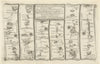
This focused collection centres on Robert Dawson’s 1832 Reform Act plan and Henry James’s 1868 boundary map of Aberavon. Road-strip mapping follows the South Wales route through Cowbridge, Aberavon and Briton Ferry in editions by John Ogilby, John Senex, Thomas Kitchin, Owen and Bowen, and Thomas Gardner, recording the town’s position between Cardiff, Neath and Swansea.
EU orders up to €150 are sent VAT- and duty-paid — no additional taxes on arrival
Authenticity Guaranteed - We only sell original antique & vintage items
Can we help? Call us on +44-208-960-3476 • FAQs
All our products are exempt from US tariffs — no additional duties or taxes payable on arrival.


- Shop by Country
- Shop by Cartographer
- Shop Maps by Type
- Shop Prints by Subject