


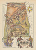




Cotton picked, ginned, pressed and loaded onto river steamers fills the prints here, beside maps that chart Alabama's counties and river ports. They include decorative sheets by Johnson and Colton, county mapping by Cram, land-cession maps associated with Royce and wider treatments linking the state with Georgia and Tennessee, as well as broader coverage of the southern United States. Mobile receives maps of its own, and the Alabama River appears through scenes of transport and trade. An illustration of Jefferson Davis's inauguration recalls the state's part in the history of the Confederacy.
EU orders up to €150 are sent VAT- and duty-paid — no additional taxes on arrival
Authenticity Guaranteed - We only sell original antique & vintage items
Can we help? Call us on +44-208-960-3476 • FAQs
All our products are exempt from US tariffs — no additional duties or taxes payable on arrival.


- Shop by Country
- Shop by Cartographer
- Shop Maps by Type
- Shop Prints by Subject