
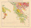


Albania's Adriatic coast and mountains, and its changing place in the Balkans, are recorded in maps by Cantelli, Mallet, Zatta and the SDUK, alongside Ottoman vilayet sheets and detailed plans of the Corfu Channel and Vlorë Bay. Some sheets reach beyond the present border into historical Epirus. First World War maps follow Durazzo, Otranto and operations on the Albanian front, and later sheets record the Greco-Italian conflict and Mediterranean naval bases. The prints, from nineteenth-century publications, show Arta, soldiers, shepherds, wedding celebrations and regional dress.
EU orders up to €150 are sent VAT- and duty-paid — no additional taxes on arrival
Authenticity Guaranteed - We only sell original antique & vintage items
Can we help? Call us on +44-208-960-3476 • FAQs
All our products are exempt from US tariffs — no additional duties or taxes payable on arrival.


- Shop by Country
- Shop by Cartographer
- Shop Maps by Type
- Shop Prints by Subject