


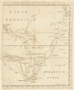


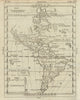


From insular California to the independent Republic of Texas, these maps capture the Americas as Europeans successively understood them. Bertius and Moll are joined by later atlas and thematic cartographers, with voyage tracks linking the continents to Pacific exploration and charts of languages, commerce, diplomatic representation and relief that reorganise the hemisphere around particular questions. Richard Edes Harrison's wartime perspective and BOAC air routes bring aviation into a tradition once dominated by coastlines and sea passages, and teaching diagrams show how publishers presented the two continents as one. The prints depict early sailing craft.
EU orders up to €150 are sent VAT- and duty-paid — no additional taxes on arrival
Authenticity Guaranteed - We only sell original antique & vintage items
Can we help? Call us on +44-208-960-3476 • FAQs
All our products are exempt from US tariffs — no additional duties or taxes payable on arrival.


- Shop by Country
- Shop by Cartographer
- Shop Maps by Type
- Shop Prints by Subject