


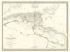

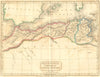

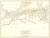

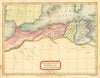


Rome's western provinces on the African shore come into focus on antique maps of ancient Mauretania, the classical region of the north-western Maghreb across parts of present-day Morocco and Algeria, set beside Numidia and Africa Propria. Sidney Hall's sheet of 1826 gives the territory its Latin place names, and Pierre Lapie's French map followed in 1829. The Society for the Diffusion of Useful Knowledge mapped it from Mauretania to Byzacium in repeated editions between 1844 and 1851, and another sheet of the same three regions dates from 1847. A French map of 1880 places the region beside Roman Hispania, while an 1885 map reconstructs it according to Bourguignat's hypothesis, complete with Atlantis.
EU orders up to €150 are sent VAT- and duty-paid — no additional taxes on arrival
Authenticity Guaranteed - We only sell original antique & vintage items
Can we help? Call us on +44-208-960-3476 • FAQs
All our products are exempt from US tariffs — no additional duties or taxes payable on arrival.


- Shop by Country
- Shop by Cartographer
- Shop Maps by Type
- Shop Prints by Subject