


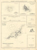





From the Faroes and Azores to St Helena and the southern ocean, these maps bring together far-flung Atlantic island groups, often assembled by atlas-makers for comparison on a single page. Early maps by Mallet, Bertius and Langenes sit beside grouped island sheets by Thomson, the SDUK and Tallis, while Admiralty charts add Fernando de Noronha and the South Sandwich Islands, and scientific material examines sea temperatures and island geology. The prints show Jamestown, Napoleon's residences on St Helena and the navigational time ball at Ladder Hill, along with Bermuda's convict road and the landscape of São Tomé.
EU orders up to €150 are sent VAT- and duty-paid — no additional taxes on arrival
Authenticity Guaranteed - We only sell original antique & vintage items
Can we help? Call us on +44-208-960-3476 • FAQs
All our products are exempt from US tariffs — no additional duties or taxes payable on arrival.


- Shop by Country
- Shop by Cartographer
- Shop Maps by Type
- Shop Prints by Subject