
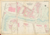


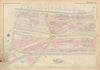

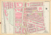

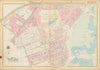

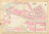

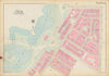


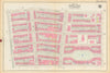


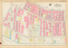

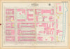


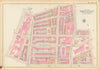


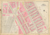


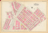

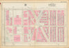


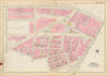


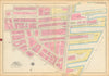


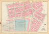

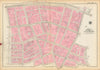

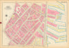

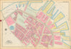

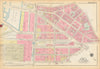

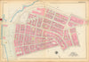


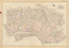

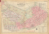

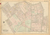
Large folio maps from "Atlas of the City of Boston - Boston Proper and Back Bay", from actual surveys and official plans published by G. W. Bromley and Co. 147 N. Fifth St. Philadelphia (1928). Explore 1920s Boston in vivid detail. Bromley’s fire insurance maps document the city at a pivotal moment between the old and the modern: street grids fully formed, Back Bay complete and elegant, new commercial towers reshaping the skyline, and the industrial waterfront still very much alive. Every building is shown footprint-accurate, with construction type, ownership, and use captured in crisp, color-coded clarity. These maps remain among the most authoritative and visually compelling records of Boston’s historic fabric at the peak of its early-20th-century confidence.
EU orders up to €150 are sent VAT- and duty-paid — no additional taxes on arrival
Authenticity Guaranteed - We only sell original antique & vintage items
Can we help? Call us on +44-208-960-3476 • FAQs
All our products are exempt from US tariffs — no additional duties or taxes payable on arrival.
- Shop by Country
- Shop by Cartographer
- Shop Maps by Type
- Shop Prints by Subject