


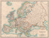

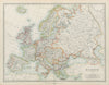

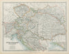

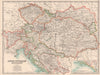
The Habsburg dual monarchy appears here before its dissolution in 1918, full of regional names that later vanished or were divided among several successor states. Most of the maps come from Johnston's atlases of the late nineteenth and early twentieth centuries. Austria and Hungary share the frame with Bohemia, Moravia, Galicia, Transylvania, Croatia, Slavonia and the Adriatic territories, and the larger sheets split the monarchy into eastern and western halves so that towns, rivers and routes can be shown in more detail. Railways and canals tie together provinces whose boundaries follow administrative history rather than today's frontiers, and some maps widen the view to Prussia, Russia and the Balkan states.
EU orders up to €150 are sent VAT- and duty-paid — no additional taxes on arrival
Authenticity Guaranteed - We only sell original antique & vintage items
Can we help? Call us on +44-208-960-3476 • FAQs
All our products are exempt from US tariffs — no additional duties or taxes payable on arrival.


- Shop by Country
- Shop by Cartographer
- Shop Maps by Type
- Shop Prints by Subject