


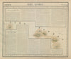


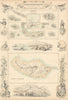


Ocean charts, harbour plans and studies of individual crater lakes give the maps of the Azores their range, from early maps of Terceira by Bertius and Langenes and Coronelli's globe geography to sea charts by Mount and Page and the Admiralty. Harbour plans cover Horta and Ponta Delgada, regional sheets place the islands among the other Atlantic archipelagos, and physical diagrams examine Sete Cidades, Furnas and the volcanic line of the chain. The prints show Angra, Santa Cruz on Flores and the crater of Corvo, island costume, wine transport and harbour disasters, and Richard Grenville's final action near Flores.
EU orders up to €150 are sent VAT- and duty-paid — no additional taxes on arrival
Authenticity Guaranteed - We only sell original antique & vintage items
Can we help? Call us on +44-208-960-3476 • FAQs
All our products are exempt from US tariffs — no additional duties or taxes payable on arrival.


- Shop by Country
- Shop by Cartographer
- Shop Maps by Type
- Shop Prints by Subject