









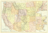


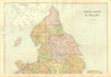


Atlantic telegraph cables, the Pacific War borders of Peru and Bolivia and the Maritime Provinces of Canada are among the subjects of these antique maps by Blackie & Son, printed between 1882 and 1893 for The Atlas & Geography of the World and the Descriptive Atlas of the World and General Geography. Belgium and the Netherlands appear with their railways and canals, and the Canadian maps take in Quebec, Nova Scotia, New Brunswick, Prince Edward Island and Newfoundland. Ocean currents, Morocco, Algeria and Tunis, Persia and Afghanistan, Pegu and Tenasserim, Sokoto and Gando, the Nile Valley, the Balkans and the Scottish Highlands extend the range.
EU orders up to €150 are sent VAT- and duty-paid — no additional taxes on arrival
Authenticity Guaranteed - We only sell original antique & vintage items
Can we help? Call us on +44-208-960-3476 • FAQs
All our products are exempt from US tariffs — no additional duties or taxes payable on arrival.


- Shop by Country
- Shop by Cartographer
- Shop Maps by Type
- Shop Prints by Subject