



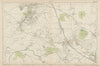


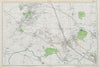


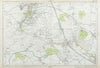

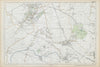


Wembley, Willesden and the River Brent share a corner of north-west London that grew from outer villages into continuous suburbs, and the maps of Brent record each stage of that change. The London Borough was formed from Wembley and Willesden in 1965, so most of these sheets show the districts before the name existed. Bacon's maps, from 1900 to 1968, cover Harrow, Wembley, Sudbury and Alperton, and Neasden, Cricklewood and Kingsbury, with geological sheets of 1900 and 1902 showing the ground beneath them. Geographers' A–Z plans of 1948 to 1964, a 1964 sheet of Wembley Stadium and Stonebridge Park, and street maps of 2000 around Dollis Hill and Brent Cross bring the story up to date, while a relief and drainage map of 1968 follows the river into the Thames basin. An 1888 print shows the Welsh Harp pub beside the Brent reservoir.
EU orders up to €150 are sent VAT- and duty-paid — no additional taxes on arrival
Authenticity Guaranteed - We only sell original antique & vintage items
Can we help? Call us on +44-208-960-3476 • FAQs
All our products are exempt from US tariffs — no additional duties or taxes payable on arrival.


- Shop by Country
- Shop by Cartographer
- Shop Maps by Type
- Shop Prints by Subject