






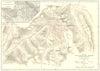




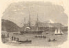


Pacific coastlines, the Fraser Canyon and the peaks of the Selkirks make these maps of British Columbia a record of a province explored by very different kinds of survey. Early sheets set the territory within western North America, while later province maps show railways, Vancouver Island and links with Alberta and the Yukon. Royal Geographical Society material examines the Selkirk and Purcell ranges, mining maps cover particular geological districts, and early twentieth-century maps of population density and ethnic origin by James White sit beside a plan of Vancouver. Prints add the Fraser Canyon, frontier scenes and coastal life.
EU orders up to €150 are sent VAT- and duty-paid — no additional taxes on arrival
Authenticity Guaranteed - We only sell original antique & vintage items
Can we help? Call us on +44-208-960-3476 • FAQs
All our products are exempt from US tariffs — no additional duties or taxes payable on arrival.


- Shop by Country
- Shop by Cartographer
- Shop Maps by Type
- Shop Prints by Subject