


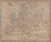


These compact copperplate maps were made to help readers find the places described in Richard Brookes's General Gazetteer, a geographical dictionary issued in successive editions from the eighteenth century onwards. They come from an 1812 edition and cover the world and the continents, including Europe, Africa, North America and South America, with separate maps of the West Indies and East Indies. They are reference maps rather than detailed surveys, showing the outline of the world an early nineteenth-century reader would have consulted.
EU orders up to €150 are sent VAT- and duty-paid — no additional taxes on arrival
Authenticity Guaranteed - We only sell original antique & vintage items
Can we help? Call us on +44-208-960-3476 • FAQs
All our products are exempt from US tariffs — no additional duties or taxes payable on arrival.


- Shop by Country
- Shop by Cartographer
- Shop Maps by Type
- Shop Prints by Subject