
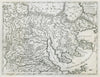


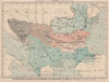


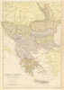


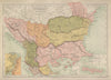


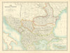


Bulgaria's shifting borders, from European Turkey to the Principality of Bulgaria and the adjustments of the Treaty of Berlin, can be followed in these maps dating from 1683 to 1958. Early engravings by Allain Manesson Mallet and Vincenzo Coronelli give way to nineteenth-century maps by the Society for the Diffusion of Useful Knowledge, W. & A. K. Johnston and Edward Stanford, which cover Sofia, Plovdiv, Veliko Tarnovo, Pleven, Varna, Burgas, Nesebar, Rousse, Nikopol, the Shipka Pass and Eastern Roumelia. The prints show military engagements along the Danube, historical flags and the territorial divisions of the region.
EU orders up to €150 are sent VAT- and duty-paid — no additional taxes on arrival
Authenticity Guaranteed - We only sell original antique & vintage items
Can we help? Call us on +44-208-960-3476 • FAQs
All our products are exempt from US tariffs — no additional duties or taxes payable on arrival.


- Shop by Country
- Shop by Cartographer
- Shop Maps by Type
- Shop Prints by Subject