


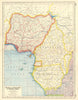


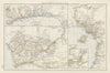



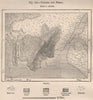

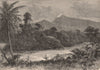


Cameroon's coast, river country and shifting colonial frontiers come through in these regional maps and landscape views. Surveys of the upper Benue associated with Flegel, maps of Lake Chad and explorers' routes lead on to later sheets under the name Kamerun, with military maps of the 1914 campaign adding another layer. Wider atlas maps connect the territory with Nigeria, Gabon and central Africa, and maps around Old Calabar and the Cross River belong to this broader frontier, with colonial boundaries unlike those of today. The prints show the Cameroon Mountains, the Lobé falls and other waterfalls and local scenes.
EU orders up to €150 are sent VAT- and duty-paid — no additional taxes on arrival
Authenticity Guaranteed - We only sell original antique & vintage items
Can we help? Call us on +44-208-960-3476 • FAQs
All our products are exempt from US tariffs — no additional duties or taxes payable on arrival.


- Shop by Country
- Shop by Cartographer
- Shop Maps by Type
- Shop Prints by Subject