
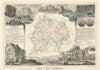


The volcanic uplands of the Massif Central, cut by gorges and dotted with small stone towns, shape these maps and prints of Cantal. Levasseur's decorated departmental sheets, maps by Perrot and Tardieu and Malte-Brun's, with its inset of Aurillac, are joined by touring maps of the Plomb du Cantal, Puy Mary and the Lioran, approached from Murat, Salers and Saint-Flour, and by physical diagrams and geological sections of the old volcano. The prints show the Cère valley, the Pas de Cère waterfall, Aurillac's old houses beside the Jordanne, town prospects and local historical portraits.
EU orders up to €150 are sent VAT- and duty-paid — no additional taxes on arrival
Authenticity Guaranteed - We only sell original antique & vintage items
Can we help? Call us on +44-208-960-3476 • FAQs
All our products are exempt from US tariffs — no additional duties or taxes payable on arrival.


- Shop by Country
- Shop by Cartographer
- Shop Maps by Type
- Shop Prints by Subject