


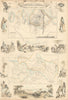


The routes of Livingstone, Cameron, Junker and other travellers cross the Congo basin and the lake country in these maps of Central Africa, from route maps and river surveys to expedition reports. Stanford, Johnston, Bartholomew and other atlas publishers followed the changing colonial territories around the Congo, Angola, the Great Lakes and the Zambezi, recording railways, missions, resources and successive political divisions. The name itself has shifted, at times covering lands later called British Central Africa, so the maps reach beyond any single modern region, with Tanganyika, the Upper Nile and routes from the Atlantic coast recurring. The prints, from nineteenth-century illustrated accounts, show river travel, lakeside settlements, dwellings, weaving and encounters, seen through the colonial perspective of their publishers.
EU orders up to €150 are sent VAT- and duty-paid — no additional taxes on arrival
Authenticity Guaranteed - We only sell original antique & vintage items
Can we help? Call us on +44-208-960-3476 • FAQs
All our products are exempt from US tariffs — no additional duties or taxes payable on arrival.


- Shop by Country
- Shop by Cartographer
- Shop Maps by Type
- Shop Prints by Subject