


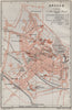

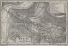

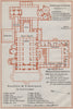



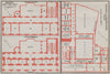


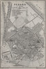


The Forum, the Vatican and the hill towns of central Italy are all planned in these maps from Central Italy and Rome, taken from the 1909 edition of Baedeker's handbook. They range from regional coverage to plans of individual towns, churches, museums and archaeological sites, with Assisi, Perugia, Orvieto, Cortona and Urbino alongside towns on the Adriatic side. Rome is shown through its ancient layout, the Palatine and the baths of Diocletian, with separate plans of the Vatican and the major basilicas. The Alban Hills, Tivoli, Sabina and the Volscian Mountains cover the excursions beyond the capital.
EU orders up to €150 are sent VAT- and duty-paid — no additional taxes on arrival
Authenticity Guaranteed - We only sell original antique & vintage items
Can we help? Call us on +44-208-960-3476 • FAQs
All our products are exempt from US tariffs — no additional duties or taxes payable on arrival.


- Shop by Country
- Shop by Cartographer
- Shop Maps by Type
- Shop Prints by Subject