Charleston, South Carolina

Historic maps and prints of Charleston, South Carolina, including city and harbour plans by John Lodge, Thomas Conder, Georg...

Read More

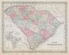
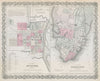
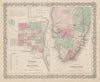
Historic maps and prints of Charleston, South Carolina, including city and harbour plans by John Lodge, Thomas Conder, George F. Cram, Baedeker and Colton; U.S. Coast Survey sheets; and Revolutionary and Civil War siege material. Coverage extends across Charleston Harbour, Forts Sumter, Moultrie and Wagner, Sullivan’s and Morris Islands, and the Ashley River, with views of St Philip’s Church, the Calhoun Monument and Custom House.

Historic maps and prints of Charleston, South Carolina, including city and harbour plans by John Lodge, Thomas Conder, George F. Cram, Baedeker and Colton; U.S. Coast Survey sheets; and Revolutionary and Civil War siege material. Coverage extends across Charleston Harbour, Forts Sumter, Moultrie and Wagner, Sullivan’s and Morris Islands, and the Ashley River, with views of St Philip’s Church, the Calhoun Monument and Custom House.