
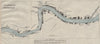


Harbour approaches, river channels and waterfronts from Tsingtao to Canton make up these maps from China Proper, the volume on economic geography, ports and communications issued by the Naval Intelligence Division in 1945. Shanghai and the Yangtze estuary lead inland through Nanking, Wuhu, Hankow and Ichang towards Chungking, while coastal plans run from Chinwangtao to Amoy, Swatow and the approaches to Canton. Smaller river ports such as Wuchow and Kongmoon add detail beyond the great trading centres, and the closely focused plans pick out individual anchorages. Place names keep the English spellings used in the wartime handbook.
EU orders up to €150 are sent VAT- and duty-paid — no additional taxes on arrival
Authenticity Guaranteed - We only sell original antique & vintage items
Can we help? Call us on +44-208-960-3476 • FAQs
All our products are exempt from US tariffs — no additional duties or taxes payable on arrival.


- Shop by Country
- Shop by Cartographer
- Shop Maps by Type
- Shop Prints by Subject