


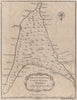


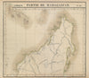


Johanna and Anjuan, the older names for Anjouan, recur on these maps of the Comoros, recalling the islands' place on the Indian Ocean sea routes. Eighteenth-century sheets by Bellin and Schley describe the individual islands and the whole group, including Grande Comore, Mohéli and Mayotte, while later atlas maps set them beside Madagascar and the Mozambique coast and an Admiralty chart serves navigators. French colonial maps use the spelling Comores and often join the archipelago to Madagascar. The prints include portraits associated with Grande Comore and a maritime disaster off Mayotte, and twentieth-century economic maps cover agriculture, trade and resources.
EU orders up to €150 are sent VAT- and duty-paid — no additional taxes on arrival
Authenticity Guaranteed - We only sell original antique & vintage items
Can we help? Call us on +44-208-960-3476 • FAQs
All our products are exempt from US tariffs — no additional duties or taxes payable on arrival.


- Shop by Country
- Shop by Cartographer
- Shop Maps by Type
- Shop Prints by Subject