


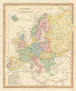


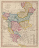


Maps by George Alexander Cooke show Europe, the Ottoman world and India as British readers saw them in the years around 1801 and 1817, when European borders were changing fast. The sheets cover Prussia, France and Italy, the European and Asian Ottoman lands and the Indian subcontinent, with a map of Europe as a whole. France is divided into departments, and the Indian map records the territories ceded by Tipu Sultan. Cooke’s name identifies the author and publishing context rather than the engraver of each sheet.
EU orders up to €150 are sent VAT- and duty-paid — no additional taxes on arrival
Authenticity Guaranteed - We only sell original antique & vintage items
Can we help? Call us on +44-208-960-3476 • FAQs
All our products are exempt from US tariffs — no additional duties or taxes payable on arrival.


- Shop by Country
- Shop by Cartographer
- Shop Maps by Type
- Shop Prints by Subject