
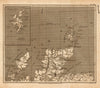


Henry Cooper engraved these compact county maps of England, Scotland and Ireland, dated 1808, for Benjamin Pitts Capper's Topographical Dictionary of the United Kingdom. The English sheets cover counties such as Durham, Cheshire, Cumberland, Leicestershire and Hampshire, as well as the eastern and western counties, while maps of northern and southern Scotland and of Ireland widen the scope and a British Isles sheet shows the whole.
EU orders up to €150 are sent VAT- and duty-paid — no additional taxes on arrival
Authenticity Guaranteed - We only sell original antique & vintage items
Can we help? Call us on +44-208-960-3476 • FAQs
All our products are exempt from US tariffs — no additional duties or taxes payable on arrival.


- Shop by Country
- Shop by Cartographer
- Shop Maps by Type
- Shop Prints by Subject