


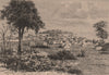

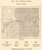


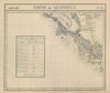


Volcanoes, coffee and two coastlines give these maps and prints of Costa Rica a striking range. Bellin's eighteenth-century maps place the province beside Nicaragua, Vandermaelen and later regional atlases set it within Central America, and more focused sheets show administrative divisions, communications and the gulfs of Nicoya and Dulce. The prints show the volcanoes of Irazú and Poás, coffee processing, Indigenous communities and the architecture of San José, while Puerto Limón and nearby islands represent the Caribbean coast. Flag plates of different dates record official and maritime designs.
EU orders up to €150 are sent VAT- and duty-paid — no additional taxes on arrival
Authenticity Guaranteed - We only sell original antique & vintage items
Can we help? Call us on +44-208-960-3476 • FAQs
All our products are exempt from US tariffs — no additional duties or taxes payable on arrival.


- Shop by Country
- Shop by Cartographer
- Shop Maps by Type
- Shop Prints by Subject