
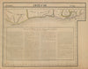


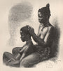


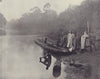

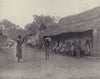











Trading settlements, river journeys and colonial administration run through these maps and views of Côte d'Ivoire, the country long labelled Ivory Coast. Bellin's eighteenth-century coastal charts and Vandermaelen's regional maps place this stretch of West Africa beside Liberia and the Gold Coast before modern boundaries took shape, and twentieth-century sheets mark Bingerville, Grand-Bassam and Abidjan, with thematic maps of agriculture, industry and natural resources. The prints show pirogues on the Tanoé, weaving, forest produce and the mosque at Bondoukou, with village and expedition scenes from Stoddard's illustrated geography. Views of Assinie and Grand-Bassam portray local rulers and inhabitants as nineteenth-century European travel and colonial publications saw them.
EU orders up to €150 are sent VAT- and duty-paid — no additional taxes on arrival
Authenticity Guaranteed - We only sell original antique & vintage items
Can we help? Call us on +44-208-960-3476 • FAQs
All our products are exempt from US tariffs — no additional duties or taxes payable on arrival.


- Shop by Country
- Shop by Cartographer
- Shop Maps by Type
- Shop Prints by Subject