
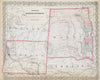


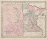


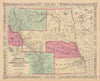


Mandan villages, a rain-maker and the chief Mah-to-toh-pa appear beside territorial and state maps in these antique maps of Dakota and prints of the northern Plains. Created in 1861, Dakota Territory first took in land beyond the present Dakotas, and from 1868 to 1889 it covered the area of North and South Dakota. Vandermaelen's American atlas maps the Missouri region before the territory existed, Johnson and Colton show it with Minnesota, Wyoming and other western neighbours, and later Bartholomew sheets map the two separate states and their counties, while a Times map sets the Dakotas within the northern Great Plains. The prints also show burial grounds.
EU orders up to €150 are sent VAT- and duty-paid — no additional taxes on arrival
Authenticity Guaranteed - We only sell original antique & vintage items
Can we help? Call us on +44-208-960-3476 • FAQs
All our products are exempt from US tariffs — no additional duties or taxes payable on arrival.


- Shop by Country
- Shop by Cartographer
- Shop Maps by Type
- Shop Prints by Subject