
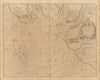

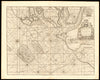


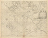


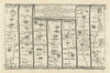


Fen drainage, coastal navigation and the roads to Norwich give these maps of East Anglia their regional sweep. Hondius’s seventeenth-century map of the Fens shows a landscape being reorganised around its waterways, while later coastal profiles and charts follow the shore from Harwich to Lowestoft, Great Yarmouth and Cromer. Ogilby’s road mapping and its successors trace the route through Newmarket, Thetford and Attleborough, Weller’s railway sheets show the Eastern Counties and Great Eastern lines, and Ward Lock maps cover the Norfolk Broads between Norwich, Beccles and the coast. First World War air-raid maps put the region to an altogether different use.
EU orders up to €150 are sent VAT- and duty-paid — no additional taxes on arrival
Authenticity Guaranteed - We only sell original antique & vintage items
Can we help? Call us on +44-208-960-3476 • FAQs
All our products are exempt from US tariffs — no additional duties or taxes payable on arrival.


- Shop by Country
- Shop by Cartographer
- Shop Maps by Type
- Shop Prints by Subject