


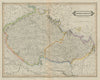

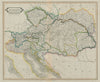


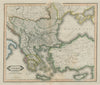


Lizars' Edinburgh Geographical General Atlas, first published in 1831 by W.H. Lizars of 3 St James’ Square, Edinburgh, with distribution by S. Highley in London and W. Curry, Jun., & Co. in Dublin, was a finely engraved 19th-century atlas offering a comprehensive overview of the known world. It featured detailed maps of every empire, state, and kingdom, reflecting both classical geography and the rapidly evolving political landscape of the time. Later editions followed through the 1830s and 1840s, incorporating updates in response to global events and colonial expansion. The maps, many engraved by William Home Lizars or under his supervision, are notable for their precision, decorative style, and finely rendered topography. Designed for both educational and reference use, the Edinburgh Geographical General Atlas exemplifies the quality of Scottish cartographic publishing in the early Victorian era and remains a valued example of mid-19th-century atlas production.
EU orders up to €150 are sent VAT- and duty-paid — no additional taxes on arrival
Authenticity Guaranteed - We only sell original antique & vintage items
Can we help? Call us on +44-208-960-3476 • FAQs
All our products are exempt from US tariffs — no additional duties or taxes payable on arrival.
- Shop by Country
- Shop by Cartographer
- Shop Maps by Type
- Shop Prints by Subject