


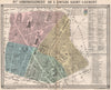

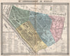

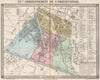

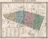


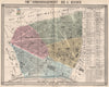


Paris district by district, at the moment its arrondissements were being transformed, fills these maps from Emile de Labédollière le Nouveau Paris. Published by Gustave Barba in 1860 and illustrated by Gustave Doré, Labédollière's work presented the newly enlarged city in detail. The plans here concentrate on individual districts, including the Temple, the Bourse, Vaugirard and the area around the northern railway stations and warehouses, showing their streets and local landmarks under the names nineteenth-century readers knew.
EU orders up to €150 are sent VAT- and duty-paid — no additional taxes on arrival
Authenticity Guaranteed - We only sell original antique & vintage items
Can we help? Call us on +44-208-960-3476 • FAQs
All our products are exempt from US tariffs — no additional duties or taxes payable on arrival.


- Shop by Country
- Shop by Cartographer
- Shop Maps by Type
- Shop Prints by Subject