


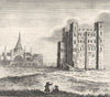


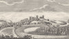

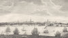


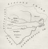


England Delineated paired compact county maps with engraved views of the towns and buildings that gave each county its character. Associated with John Aikin and published for J. Johnson around the turn of the nineteenth century, the book's maps cover Dorset, Essex, Rutland and Suffolk, along with an overview of England and Wales. Its prints take the reader to Canterbury, Guildford, Lancaster and Liverpool and to the castles at Dover, Rochester and Hornby, some plates setting several prospects on one sheet.
EU orders up to €150 are sent VAT- and duty-paid — no additional taxes on arrival
Authenticity Guaranteed - We only sell original antique & vintage items
Can we help? Call us on +44-208-960-3476 • FAQs
All our products are exempt from US tariffs — no additional duties or taxes payable on arrival.


- Shop by Country
- Shop by Cartographer
- Shop Maps by Type
- Shop Prints by Subject