


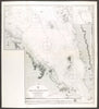


Red Sea harbours and the hard climb from the coast into the highlands shape these maps of Eritrea and prints of the British Abyssinian expedition. Admiralty coverage near Bab el-Mandeb and regional sheets by Vandermaelen and Petermann are joined by closer maps of Massawa, Assab and the Gulf of Zula. The prints record landing places, harbour buildings, wells, mangroves and inhabitants, and the piers at Zula and the Kumaili valley show the expedition's coastal base against the difficult country beyond. Archaeological details from Adulis add an older history, and battlefield mapping of Keren brings in the East African campaign of the Second World War.
EU orders up to €150 are sent VAT- and duty-paid — no additional taxes on arrival
Authenticity Guaranteed - We only sell original antique & vintage items
Can we help? Call us on +44-208-960-3476 • FAQs
All our products are exempt from US tariffs — no additional duties or taxes payable on arrival.


- Shop by Country
- Shop by Cartographer
- Shop Maps by Type
- Shop Prints by Subject