


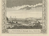


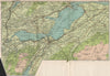

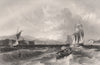
The collection brings together the 1832 Dawson Reform Act plan of Fortrose and Rosemarkie, Taylor and Skinner’s 1776 road strip through the Black Isle, and John Bartholomew’s 1911 Inner Moray Firth map. Views include Thomas Allom’s Moray Firth prospect with Fort George and Fortrose, and George Augustus Walpoole’s 1794 engravings of Chanonry—an earlier name for Fortrose.
EU orders up to €150 are sent VAT- and duty-paid — no additional taxes on arrival
Authenticity Guaranteed - We only sell original antique & vintage items
Can we help? Call us on +44-208-960-3476 • FAQs
All our products are exempt from US tariffs — no additional duties or taxes payable on arrival.


- Shop by Country
- Shop by Cartographer
- Shop Maps by Type
- Shop Prints by Subject