


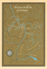


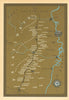


Antique and vintage maps of Germany’s wine regions range from nineteenth-century mapping to colourful twentieth-century promotional designs. Detailed Rhine vineyard and soil maps, Lintz’s Mosel sheets and Sheila Waters’s regional maps for André Simon sit alongside Deinhard’s pictorial Rhine and Moselle map, The German Wine-Producing Districts poster and Die deutschen Weinlande. Castles, vineyards, coats of arms, wine presses and barrels bring the promotional maps to life. Coverage includes the Rhine, Mosel, Saar, Ruwer and Ahr, extending to Rheingau, Rheinhessen, Nahe, Pfalz, Franconia, Baden and Württemberg. These original maps combine the history and geography of German wine with decorative appeal for wine lovers and collectors.
EU orders up to €150 are sent VAT- and duty-paid — no additional taxes on arrival
Authenticity Guaranteed - We only sell original antique & vintage items
Can we help? Call us on +44-208-960-3476 • FAQs
All our products are exempt from US tariffs — no additional duties or taxes payable on arrival.


- Shop by Country
- Shop by Cartographer
- Shop Maps by Type
- Shop Prints by Subject