


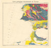

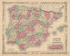


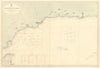


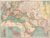


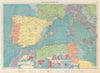


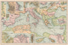


The Rock, its fortifications and the gateway to the Mediterranean recur in these maps of Gibraltar, from the eighteenth to the twentieth century. Plans by Lodge, Gibson and later publishers examine the town and its defences, coastal and sea charts link it with the Strait, the Spanish shore and northern Morocco, military maps record the relief of Gibraltar, and route maps show it as a staging post on the way to India. The prints give views from the sea and around the bay, shipping incidents and the town below the Rock, with Bartlett's illustrations among the nineteenth-century views.
EU orders up to €150 are sent VAT- and duty-paid — no additional taxes on arrival
Authenticity Guaranteed - We only sell original antique & vintage items
Can we help? Call us on +44-208-960-3476 • FAQs
All our products are exempt from US tariffs — no additional duties or taxes payable on arrival.


- Shop by Country
- Shop by Cartographer
- Shop Maps by Type
- Shop Prints by Subject