


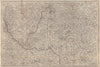

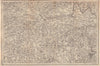


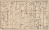


War news and shifting colonial frontiers give John Gibson's maps their topical edge, compact images for readers following events in the 1750s and 1760s. A London mapmaker and engraver, Gibson prepared maps for the Gentleman's Magazine of the campaigns around Quebec and Montreal, the Caribbean islands and the contested lands of central Europe, with Saxony, Bohemia and Silesia in detail. British North America, the new Florida governments and the St Lawrence follow empire and settlement, while British road maps and the Duke of York's Italian journey add travel. He also engraved hemispheres and Arctic geography.
EU orders up to €150 are sent VAT- and duty-paid — no additional taxes on arrival
Authenticity Guaranteed - We only sell original antique & vintage items
Can we help? Call us on +44-208-960-3476 • FAQs
All our products are exempt from US tariffs — no additional duties or taxes payable on arrival.


- Shop by Country
- Shop by Cartographer
- Shop Maps by Type
- Shop Prints by Subject